Hand-Drawn Map of Matrimony


Hand-Drawn Map of Matrimony
Ref: 11047
SOLD
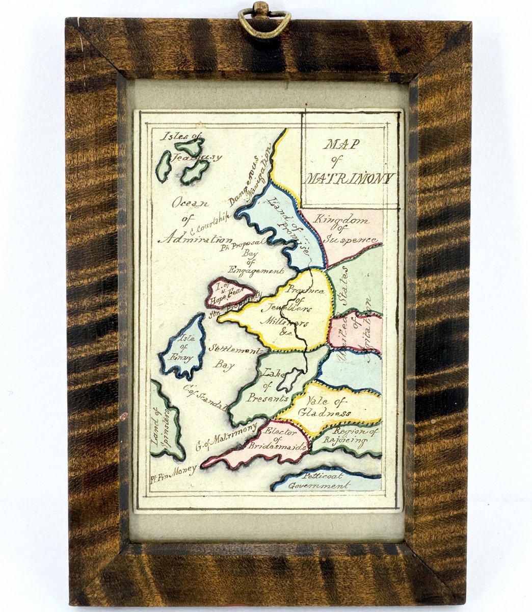
Up until now, this is something I'd only seen depicted in books. This is an early 19th century hand-drawn and coloured "Map of Matrimony", with place names such as "Isle of Jealousy", "Kingdom of Suspense", "Province of Jewellers and Milliners", "Settlement Bay", "United States of Agitation", etc.. It measures only 3" x 4.5" and would've required quite a steady hand to draw out in such small scale.
These playful sketches were often done up and given away to a special someone as love tokens or valentines. This particular example was found tucked inside an 1820's autograph album. We placed it within a period 4.5" x 6.5" curly maple frame for display.
Dimensions: 4.5"x6.5"
Enquiry Form